Surveying
Boundary Surveys
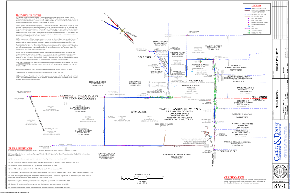
Boundary surveys typically begin with research and end with setting pins to monument the locations of the boundaries determined by the survey. From beginning to end Gartley & Dorsky's goal is to provide a survey that is based on thorough research and reconnaissance, accurate collection of the evidence in the field, and a thoughtful and thorough analysis of the evidence with respect to the deeds when determining the boundaries on the final plan. Our boundary surveys range from small in town lots for the landowner who wants to install a fence to hundreds of acres for a landowner developing a forestry plan.
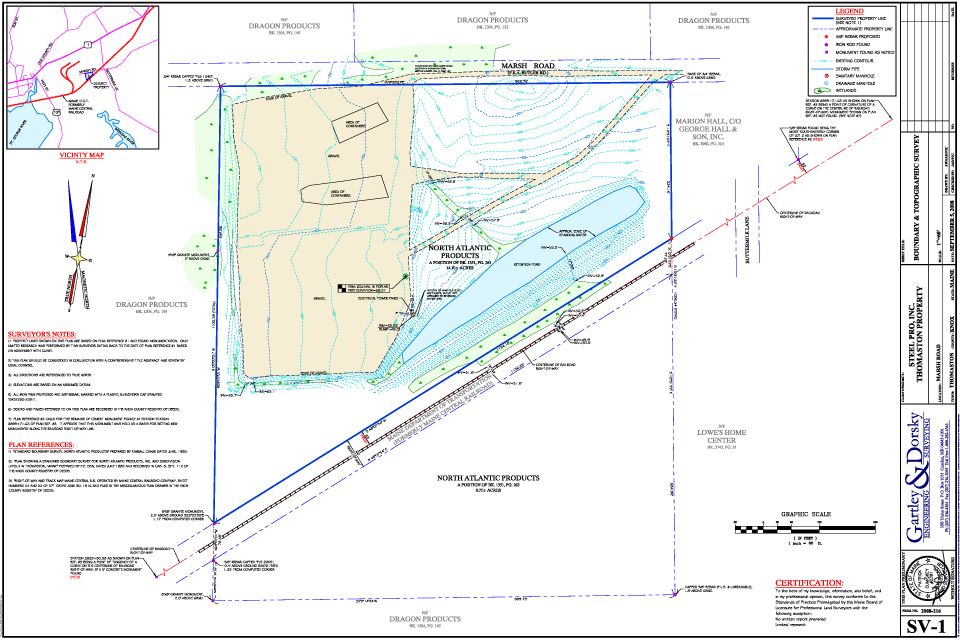
Topographic/As-built Surveys
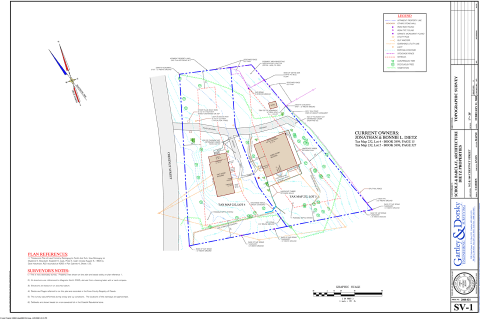
The multidisciplinary nature of our company means that Gartley & Dorsky's survey crews have extensive experience performing topographic and as-built surveys. We utilize centimeter accurate RTK GPS equipment on larger open sites to increase speed and efficiency. On smaller open sites we may use our robotic total station as part of a one person crew. The data gathered is downloaded onto a computer and used to generate an existing site plan showing improvements and other features specified by the client as well as contours if desired.
ALTA/ACSM Land Title Surveys
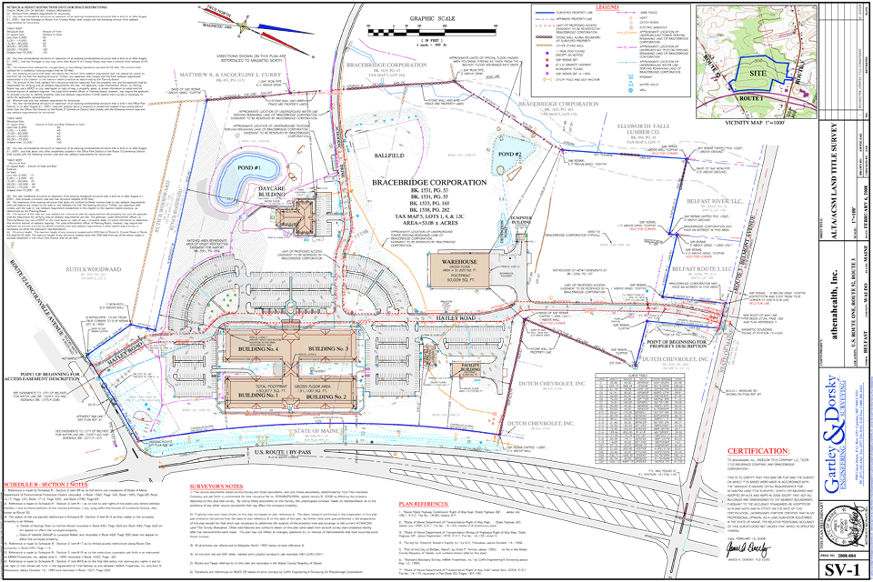
Gartley & Dorsky has performed ALTA surveys on many commercial properties in Maine. We work closely with our clients and title companies to ensure a quality product addressing all of their requirements. Our colorful well organized plans make it easy to review our surveys with the associated title commitment or title policy. Click on the following link for information on ALTA surveys and the current ALTA standards http://www.alta.org/standards/standards.cfm
Subdivisions
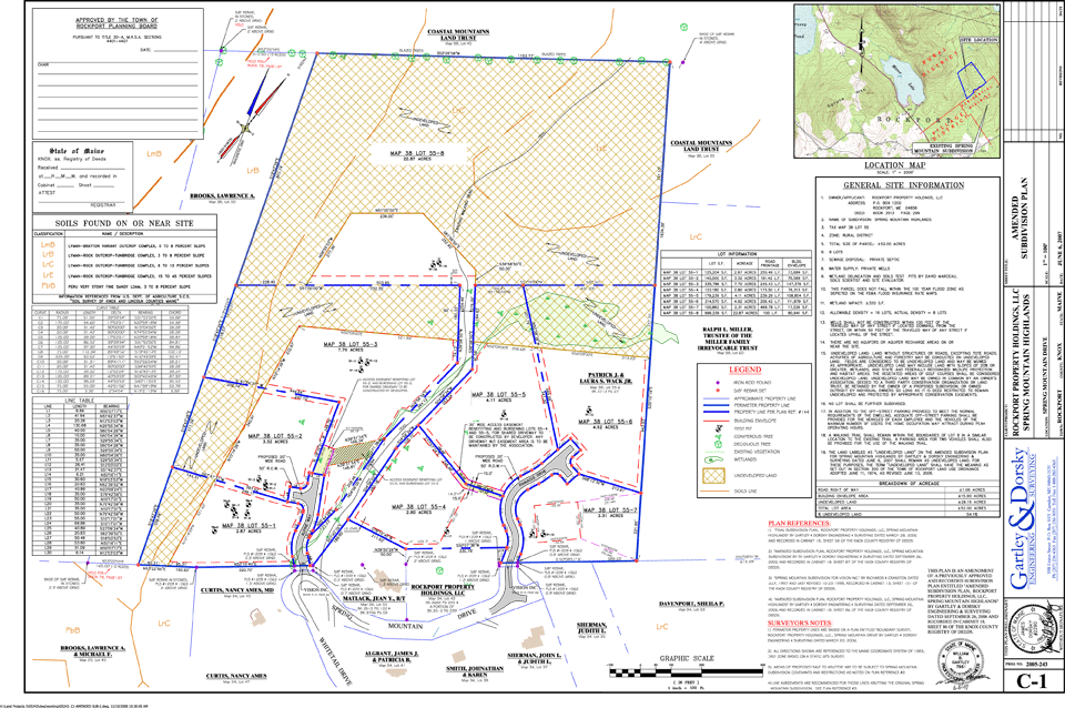
From a 3 lot subdivision along an existing town road to large subdivisions requiring engineering design and local and state permitting, Gartley and Dorsky has the in-house capabilities to get the job done. Our surveyors, soil and wetland scientist, and engineers work as a team to guide your project through the process.
Condominium Plats and Plans

Gartley & Dorsky has created Condominium Plats and Plans for many clients over the past several years. These projects bring unique requirements. Our surveyors are well versed in those requirements and can work with your attorney to make the plat and plans consistent with the declaration.
Elevation Certificates/LOMAs
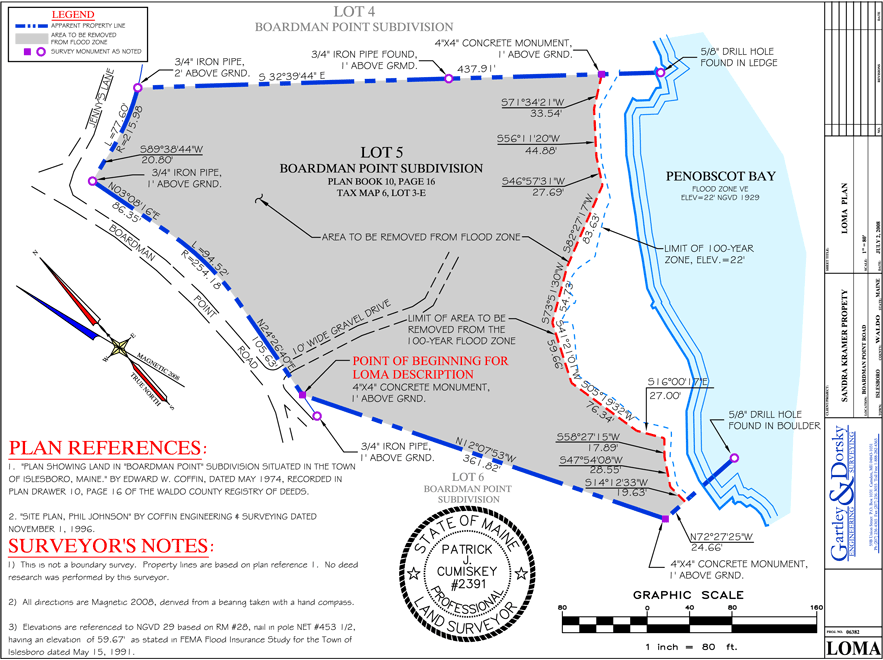
There are several forms that may be required by your insurance company, lender, or local code enforcement officer that relate to flood zones. We can help you decide which form is right for your situation and in most cases prepare and submit the appropriate documentation to FEMA or whoever is requesting the form.
Hydrographic Surveys

Gartley & Dorsky utilizes specialized equipment and software to model the surface of the ground under water. Our hydrographic surveying system starts with our echo sounder capable of reading depths of more that 1500 feet and accurate to +/- 0.1% of depth. The echo sounder is connected to a laptop computer on our survey boat which is also connected to our centimeter accurate RTK GPS system. The laptop uses Hypack software to integrate all of this data and produce a 3-D position on the under water surface. This system enables us to cover large areas in a short amount of time. Camden Harbor, for instance, was run with lines spaced 25 feet apart in approximately 3 hours. This type of survey can be helpful when designing a pier or for pre and post dredging to determine volumes and find high spots.
GPS Services
We use both survey grade and mapping grade GPS receivers. The mapping grade receiver is a sub-meter accurate receiver and is used for mapping wetlands, reconnaissance on large tracts of land, or locating other features where this level of accuracy is appropriate. Our survey grade receivers are dual frequency receivers and are used to provide centimeter level accuracy for control networks on large projects, photo control for aerial surveys, to bring elevations to sites from distant benchmarks, and in RTK mode (real time kinematic) to perform topographic surveys on large open sites.
Construction Layout
Gartley and Dorsky performs construction layout on a wide variety of projects including roads, site layout for commercial development, residential structures, and large commercial buildings.